LakeList
FavoritesStateWisconsin
Firth Lake depth map
Historical depth chart
Scanned Wisconsin DNR lake survey depth maps for Firth Lake in Chippewa County, Wisconsin, converted so they can be panned and zoomed in the browser. Historical surveys — not for navigation.
22max depth feet
Unknownmean depth feet
47surface acres
1DNR depth map sheet
Historical Wisconsin DNR maps
Firth Lake depth maps
1 converted map sheet. These historical surveys are not for navigation.
Navigable depth map
Firth Lake · sheet 1
Pan, zoom, and inspect the converted Wisconsin DNR historical map image in the browser. Historical survey — not for navigation.
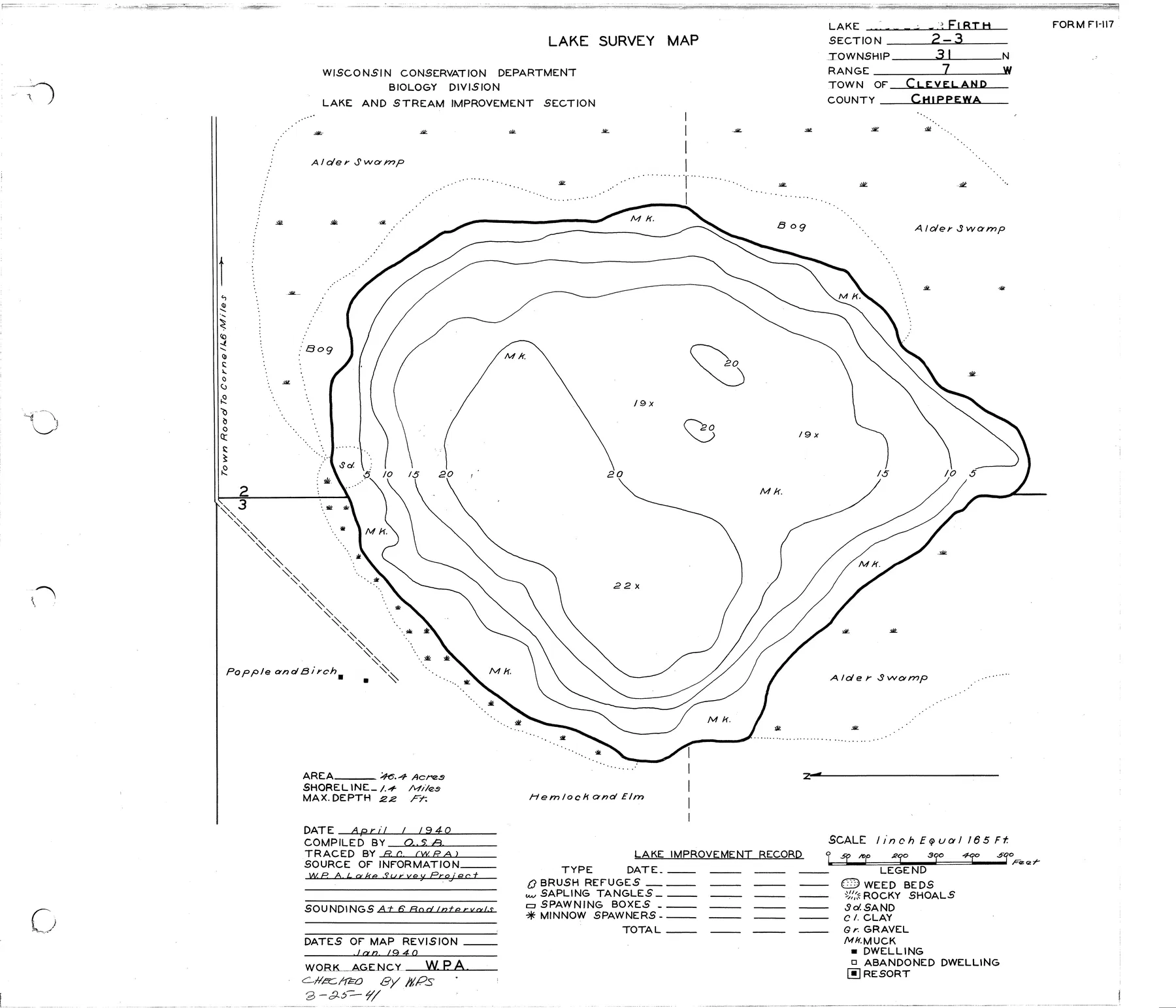
Source: Wisconsin DNR · WBIC 2176200 · image navigation only; spatial alignment pending · Historical lake maps are not for navigation.
Source: Wisconsin Department of Natural Resources. Converted for browser access with source URLs, checksums, and retrieval dates retained. Historical lake maps are not for navigation.
Depth FAQ
How deep is Firth Lake?
Firth Lake is 22 feet deep at its deepest point, according to Wisconsin DNR records.
Is there a free depth map of Firth Lake?
Yes. 1 scanned Wisconsin DNR lake survey map sheet is free to view and zoom on LakeList. These historical surveys are not for navigation.
Where does the Firth Lake depth map come from?
The map sheets are converted from official Wisconsin DNR lake survey documents, with the source URL, checksum, and retrieval date retained for every sheet. Historical surveys are not for navigation.