Lake of the WeekOn the Water
9 Ways to Spend a Day on Lake Minocqua
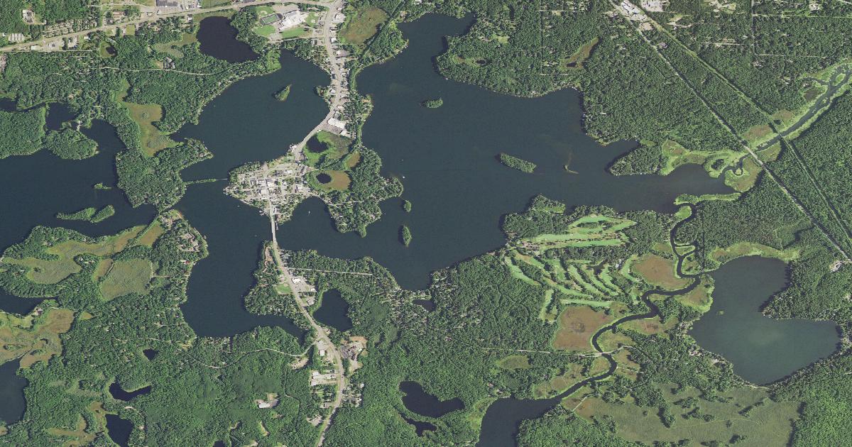
Most Northwoods towns sit beside a lake. Minocqua sits inside one. The downtown occupies what was an actual island — the visitor bureau still calls it that, reached now by the Highway 51 bridge and by "the fill" to the north — and the water wraps most of the way around it. You can walk from a bar to a beach to a boat launch in about ten minutes.
That geography is the reason this lake is worth a whole day rather than an afternoon. Here are nine ways to spend one, from the ski show that has run since Truman was president to the 1972 survey sheet that still knows the lake better than anybody's memory does.
Watch a ski show that has run since 1950
The Aqua Bowl, W. Park Ave.
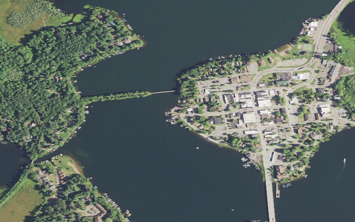
The west end of the lake along W. Park Ave., where the Min-Aqua Bats ski. USDA NAIP via USGS (Public domain) The Min-Aqua Bats started as a group of local kids water skiing on Sunday afternoons in 1950 and never stopped. They now bill themselves as the oldest continually running amateur water ski show in the world; the Town of Minocqua calls them the longest-running in the nation. Neither superlative is settled, and neither is the point.
Shows are free, at 7 p.m. on Sundays, Wednesdays and Fridays, rain or shine. Nobody sells you a ticket — the club is a nonprofit funded by sponsors and by passing the hat at halftime, a habit the skiers started to pay for safety equipment as the crowds grew.
Before you go: The 2026 season opened June 10 and closes Sunday, August 16. The club's own /shows page is stale and still serves 2023 dates; the homepage is the one to trust.
Walk out over the lake on a railroad grade
Bearskin State Trail, north trailhead downtown
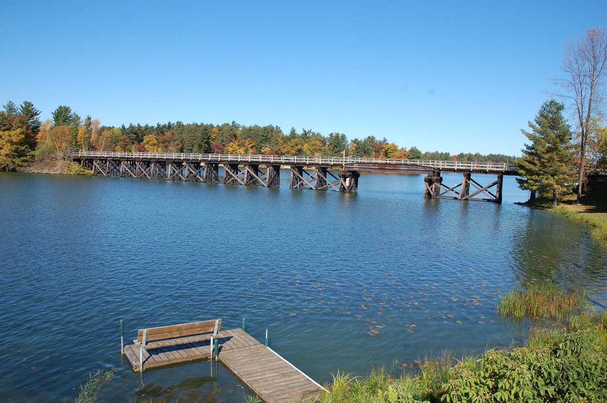
The old railroad trestle over Lake Minocqua, now the Bearskin State Trail. Photographed in October. “Squirrel lake” via Wikimedia Commons (CC BY-SA 4.0) The Chicago, Milwaukee & St. Paul pushed a line up here in 1887 to move white pine south — the DNR's own phrasing is that it was built to export logs to the cities of the Midwest. Passenger service followed in January 1888: five hours from Merrill, arriving 12:05 p.m. From 1919 the railroad ran a weekend "Fisherman's Special" out of Chicago, nine Pullman sleepers and two coach cars, leaving at 6:10 Friday evening and pulling in at 6:45 Saturday morning. It ran until 1948.
The right-of-way was abandoned in late 1972 and the state held the deed by November 1973. What is left is 21.5 miles of compacted granite running south toward Tomahawk, with thirteen trestles crossing water along the way — including the one out of town, which is the only place you can stand over this lake without a boat.
Before you go: Walking and hiking are free. Bicyclists 16 and older need a Wisconsin state trail pass: $5 daily or $25 annual in 2026.
Swim without leaving downtown
Torpy Park, 705 Oneida St.
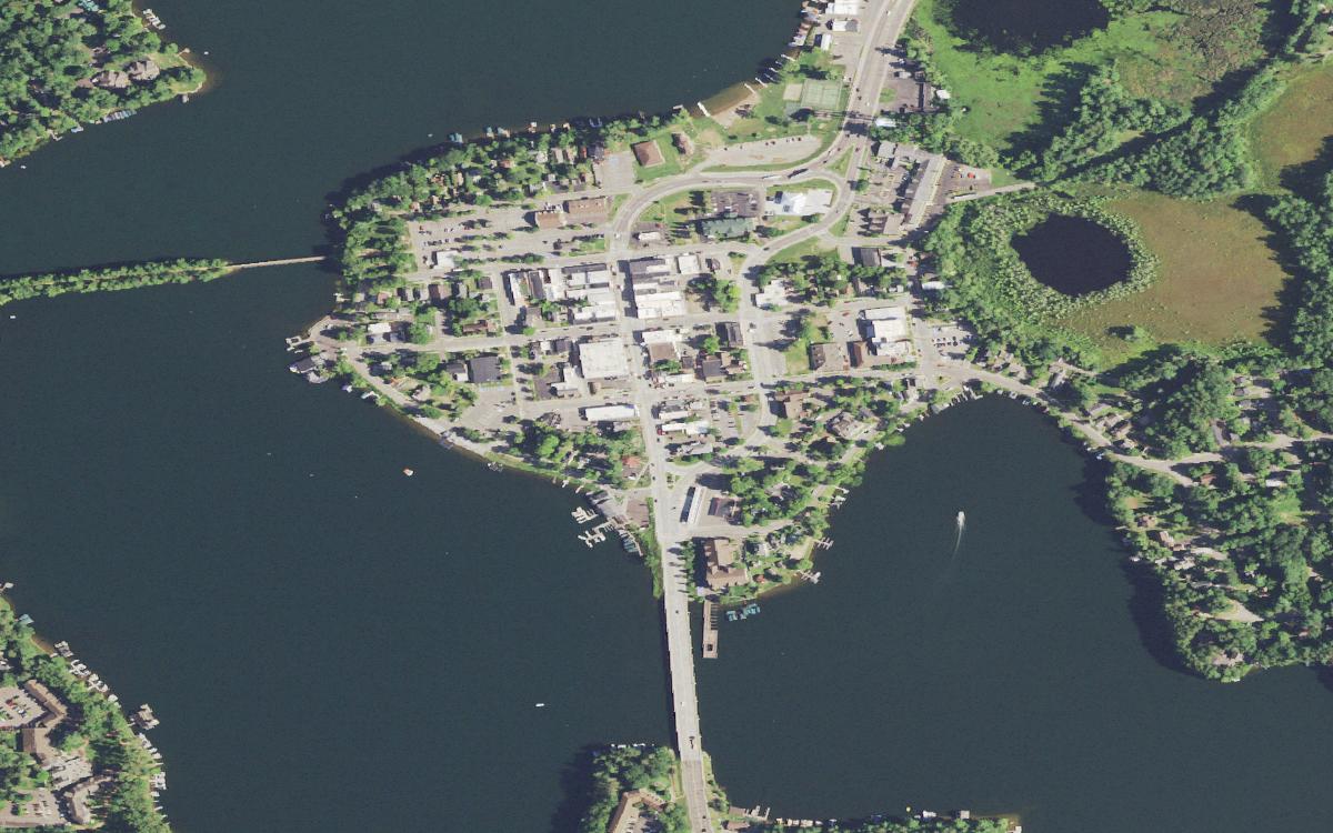
The Island City. Highway 51 crosses south on the causeway; the old rail grade — now the Bearskin Trail — runs west at upper left. USDA NAIP via USGS (Public domain) Four waterfront acres on the same island as the shops: a beach, restrooms, a playground, tennis and sand volleyball courts, picnic shelters with grills, and a seasonal concession stand. In winter the same ground becomes an ice skating rink.
The practical appeal is that you can park once. Beach, lunch, a bookstore and a boat launch are all inside a few blocks, which is not true of most lakes this size.
Before you go: The Town of Minocqua warns in capitals that there are no lifeguards on duty. Two things visitor-bureau write-ups add — changing rooms and public docks — are not on the town's own amenity list.
Eat on top of the water, in a building nobody can build again
453 W. Park Ave.
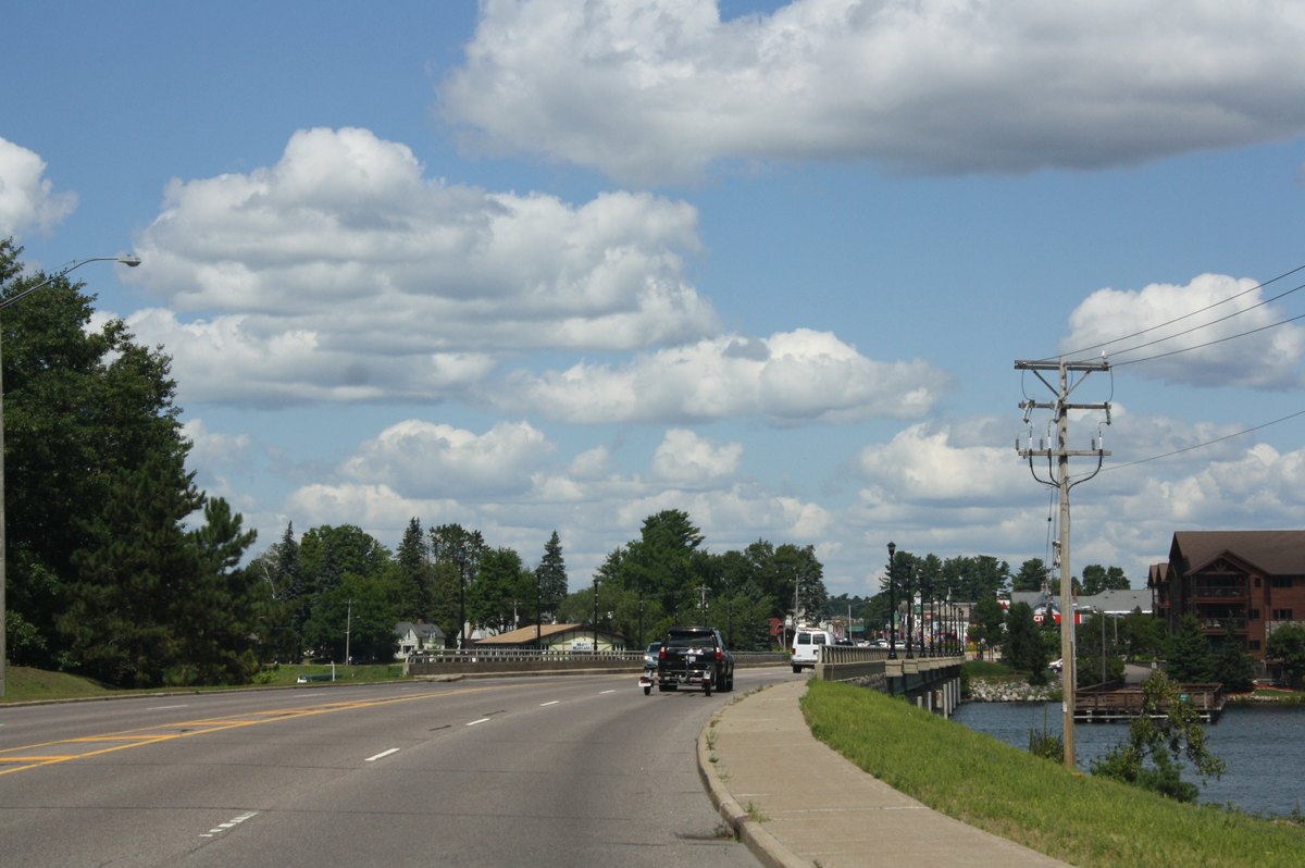
The Highway 51 bridge onto the island. The Thirsty Whale sits over the water off W. Park Ave. Royalbroil via Wikimedia Commons (CC BY-SA 3.0) The Thirsty Whale stands entirely over Lake Minocqua, which is the town's own description of it. It went up in February 1902, when Dick Hoover and a partner put up a boathouse to run a boat livery for the coming spring season. It has been Hoover and Winger, Pleasant View, the Town Dock Boathouse, Bassetts and Joe's Marine Bar since, picking up the Thirsty Whale name in 1970.
It survives on a technicality of state law. Wisconsin closed the door on structures like it after December 16, 1979, when the statute barred any new boathouse beyond the ordinary high-water mark of a navigable waterway. Existing ones may be repaired and maintained. This one predates the line by 77 years.
Before you go: Its own site lists the kitchen Wednesday through Sunday, 11:30 a.m. to 8 p.m., and until 9 on Fridays.
Keep going — this lake is one of seven
The Minocqua Chain
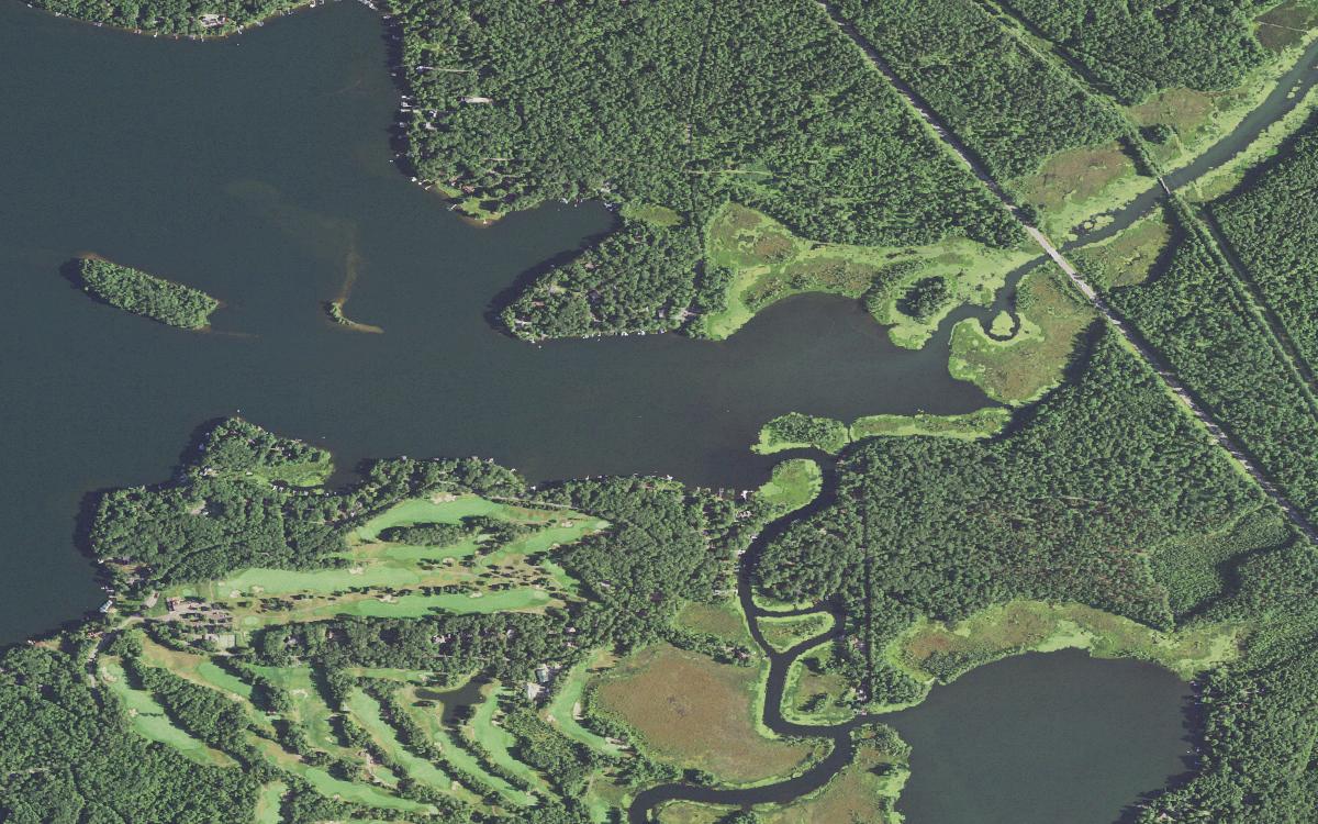
The east end, and the thoroughfare winding south toward the rest of the chain. USDA NAIP via USGS (Public domain) Minocqua is the second-largest water in a 5,929-acre chain that the DNR lists as Kawaguesaga, Minocqua, Jerome, Mid, Tomahawk, Little Tomahawk and Mud, plus the Minocqua and Tomahawk thoroughfares tying them together. Tomahawk is the big one at 3,462 acres; Minocqua is 1,339; Kawaguesaga is 700. Together they form the headwaters of the Tomahawk River.
That means a boat launched here is not confined here. The thoroughfares are the whole reason people keep boats on this chain rather than a bigger single lake.
Before you go: The town's Thoroughfare ramp on Thoroughfare Rd. is filed under Lake Tomahawk, not Minocqua — from it you can, in the town's words, boat south to Lake Tomahawk or north to Lake Minocqua.
Read the lake's own paperwork
The July 1972 DNR survey sheet
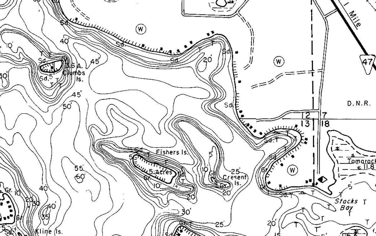
Detail of the July 1972 Wisconsin DNR survey sheet — Clumbs Island inside the 40- to 50-foot contours, with Fishers and Cresent islands below. Not for navigation. Wisconsin DNR lake survey sheet, July 1972 (Public record) A crew ran recording sonar over this basin in July 1972 and drew what they found. The sheet puts 55 percent of the lake deeper than 20 feet and only 6 percent shallower than three — 31,765 acre-feet of water inside 15.68 miles of shoreline. From the surface it reads as a wide, friendly, downtown lake. It is not especially shallow anywhere.
The other thing the sheet carries is names. School House Bay, Huber Bay, Kennedy Bay, Stacks Bay. Fishers, Clumbs, Kline, Jossart and Cresent islands, Cresent spelled exactly that way. Those are 1972's labels, not necessarily what anyone says now, though two of them still ride on boat launches.
Before you go: That 1972 sheet is also the newest agency depth survey on file here. The interactive contours on our lake page come from community sonar recordings — better than a model, still an estimate, and not survey linework.
Fish it with the numbers in front of you
Four public launches
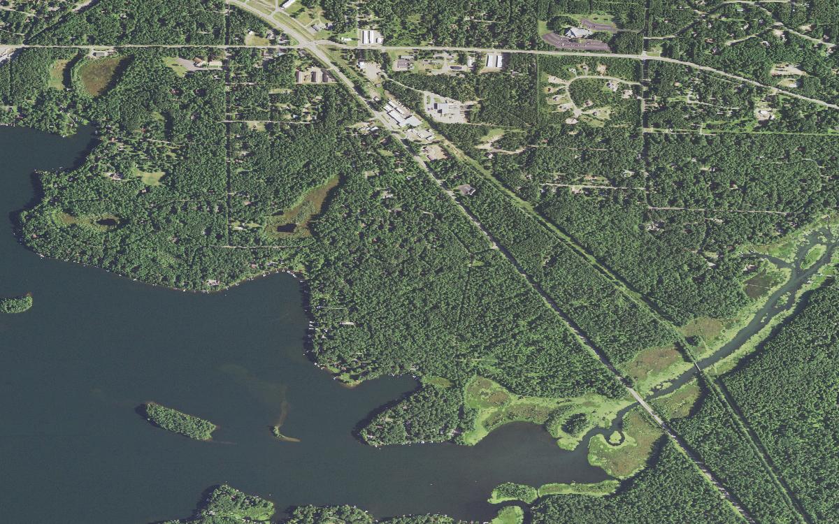
The eastern basin, where the 1972 sheet puts most of the deep water. USDA NAIP via USGS (Public domain) The 2024 DNR spring survey put hands on 1,464 walleye here, from 5.7 to 30 inches, and worked the mark-recapture up to an estimated 3,880 adults. The estimate is an estimate; the 1,464 is a count. The same survey's late-spring electrofishing logged 123.3 bluegill and 6.6 largemouth per mile — catch rates tied to gear and effort, not populations. The state stocked 13,340 large walleye fingerlings the following year.
Four public launches are on file, all matched against the DNR boat-access layer in July 2026. Chicago Avenue and Park Street are paved and flagged ADA-accessible; Stacks Bay is paved without the flag; Cedar Street is gravel.
Before you go: The Town of Minocqua charges $10 daily at its three town-owned ramps, April 1 through November 30, by QR code at the ramp rather than the old envelope box. Check current DNR regulations before you keep anything — the DNR's own Minocqua Chain page has gone stale on rules.
Look up
Anywhere on the water, early
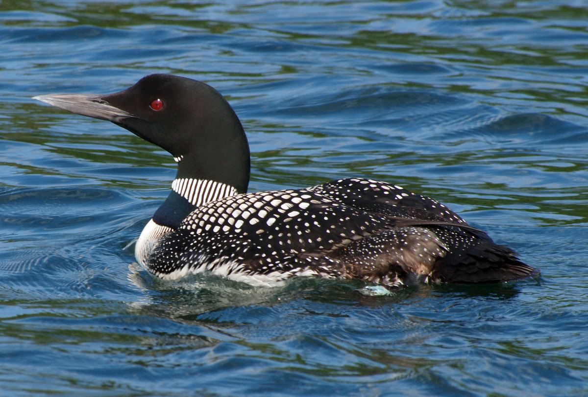
A common loon on the water at Minocqua. John Picken (CC BY 2.0) Common loons and bald eagles both photograph well here, and both have been shot on this lake by photographers who released the images openly — the two on this page are from Minocqua itself, not stock from somewhere else.
We do not publish a wildlife count for this lake and will not pretend to. What we can tell you is that the birds are why a lot of people take the first boat out rather than the noon one.
Before you go: Nothing to book and nothing to pay for. The quietest water is before the ski boats start.
Breakfast, and one strange thing on the way out
314 Oneida St., then Woodruff
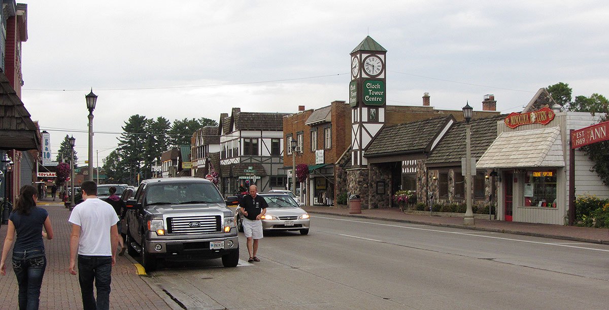
Downtown Minocqua. Commerce moved to Oneida Street after the 1912 fire. Freekee via Wikimedia Commons (CC0) Island Cafe does breakfast and lunch four days a week and has carried the name since 1957 by its own account. Four days is the catch — it is shut Monday through Wednesday, which is exactly when an early launch makes you want it.
Then, five minutes north in Woodruff, there is a ten-foot copper penny weighing something like 17,450 pounds. In the fall of 1952 a high-school geometry class set out to collect a million pennies to finish a hospital for Dr. Kate Pelham Newcomb, the country doctor who reached patients by snowshoe and canoe. About 1.7 million arrived in 104 days from all 48 states. Ten thousand people turned out for the parade. The hospital opened in 1954.
Before you go: Island Cafe: Thursday through Sunday, 7 a.m. to 2 p.m. The penny is a free outdoor monument at 820 Third Ave., a block from the Dr. Kate Museum — not inside it.
Everything above is checked against a primary source and dated, because hours and seasons move. If we have something wrong — or if there is a newer DNR sounding of this basin than 1972 — tell us and we will fix the page.
All the data for Minocqua Lake — depth map, surveys, launches