LakeList
FavoritesStateWisconsin
Lake Chetac depth map
Interactive depth contours
Interactive depth contours for Lake Chetac in Sawyer County, Wisconsin, derived from C-MAP Genesis community sonar (derived) survey data. Pan the map, inspect contour depths, or open the 3D underwater view.
26max depth feet
14mean depth feet
2,400surface acres
15mapped depth contours
Lake ChetacSawyer County, WI
Contours load with map Access
Interactive depth contours5-foot typical interval · Sonar-derived depth (C-MAP Genesis) · Gaps interpolated · Not for navigation
Source: C-MAP Genesis community sonar (derived)high confidence · QA passed · Select a contour to inspect its mapped depthDepths decoded from C-MAP Genesis Social Map community sonar recordings (used with permission), covering 82% of the lake. Small gaps between recordings are smoothly connected; larger unrecorded areas follow the lake's depth model calibrated to the DNR-documented 26-ft maximum depth. More accurate than a pure model, but still an estimate. Not for navigation.Historical Wisconsin DNR maps
Lake Chetac depth maps
2 converted map sheets. These historical surveys are not for navigation.
Navigable depth map
Lake Chetac · sheet 1
Pan, zoom, and inspect the converted Wisconsin DNR historical map image in the browser. Historical survey — not for navigation.
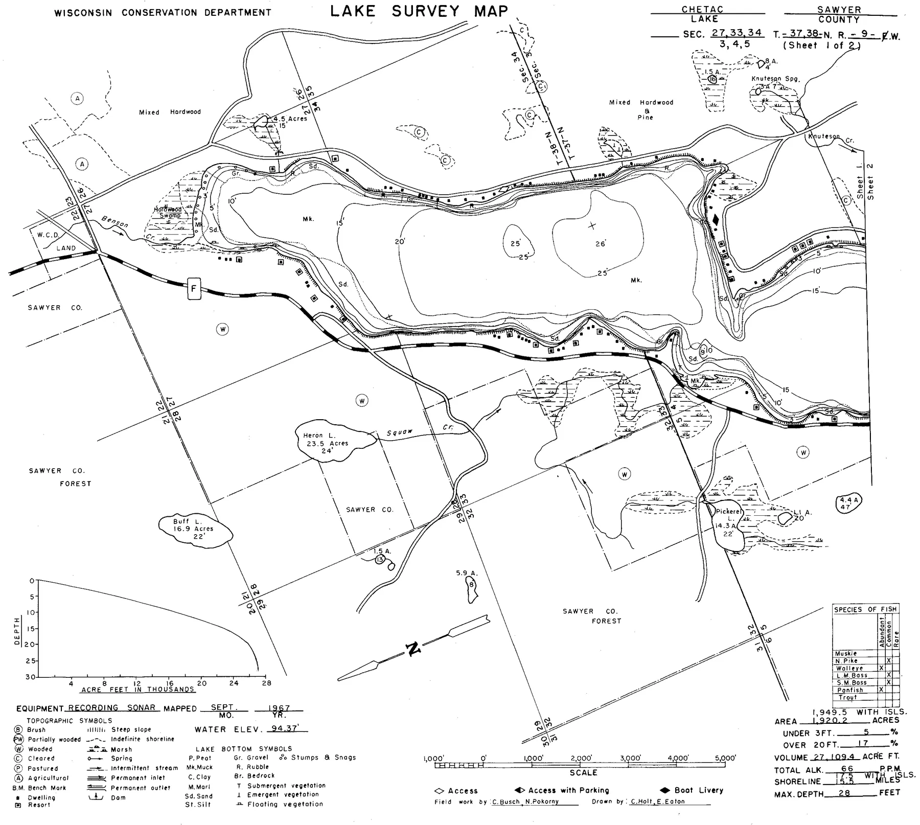
Source: Wisconsin DNR · WBIC 2113300 · image navigation only; spatial alignment pending · Historical lake maps are not for navigation.
Source: Wisconsin Department of Natural Resources. Converted for browser access with source URLs, checksums, and retrieval dates retained. Historical lake maps are not for navigation.
Depth FAQ
How deep is Lake Chetac?
Lake Chetac is 26 feet deep at its deepest point and averages about 14 feet, according to Wisconsin DNR records.
Is there a free depth map of Lake Chetac?
Yes. LakeList publishes a free interactive depth contour map of Lake Chetac at a typical 5-foot interval, with an optional 3D underwater view, derived from C-MAP Genesis community sonar (derived) survey data.
Where does the Lake Chetac depth map come from?
The interactive depth contours are derived from C-MAP Genesis community sonar (derived). Each contour set passes a visual QA review against the source document before it is published. The depths are derived from community sonar recordings (C-MAP Genesis Social Map, used with permission), with gaps between recordings interpolated; not for navigation.