2025
WalleyeChippewa/St. Croix · Large Fingerling
1,0117.0 in average
LakeList assistant
Fishing spots, food, lodging, marinas, and rentals around McCann Lake.
Start here
Fishing
Fishery
Angler reports · Fishbrain
Anglers have logged 15 catches on McCann Lake via Fishbrain — 3 in the last 30 days, most recently on Jul 25, 2026.
Counts reflect reporting activity, not fish populations. Waterbody location is provider-level; exact spots and angler details aren’t shown.
Fishery details for this lakeExplore this area on FishbrainWisconsin DNR stocking
The latest published year is 2025, when 2,271 fish were recorded across 2 entries.
Showing the 12 most recent records from 15 published entries.
NWS weather
Weather-based planning from the National Weather Service hourly forecast near this lake — not a catch forecast.
Checking wind, precipitation, and near-term weather windows.
Water temperature
Modeled surface-temperature estimate built from seasonal climate, lake depth, and live National Weather Service air temperatures near this lake.
Seasonal estimate. Checking current National Weather Service air temperatures…
Comfortable summer pattern. Bass and panfish are active; early and late hours beat the midday heat.
Estimates are modeled, not measured. Actual temperatures vary with depth, wind mixing, and recent weather — verify conditions before swimming, boating, or heading onto ice.
Official Wisconsin information
LakeList links to the authoritative record so you can verify maps, rules, and current notices before leaving.
Historical depth maps are not for navigation. Verify regulations and access at the official source before your trip.
Historical Wisconsin DNR maps
1 converted map sheet. These historical surveys are not for navigation.
Navigable depth map
Pan, zoom, and inspect the converted Wisconsin DNR historical map image in the browser. Historical survey — not for navigation.
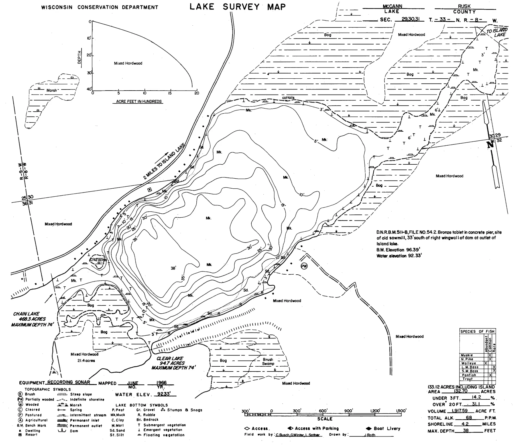
Source: Wisconsin DNR · WBIC 2350400 · image navigation only; spatial alignment pending · Historical lake maps are not for navigation.
Source: Wisconsin Department of Natural Resources. Converted for browser access with source URLs, checksums, and retrieval dates retained. Historical lake maps are not for navigation.
Access
Nearby
Depth FAQ
McCann Lake is 38 feet deep at its deepest point and averages about 14 feet, according to Wisconsin DNR records.
Yes. LakeList publishes a free interactive depth contour map of McCann Lake at a typical 5-foot interval, with an optional 3D underwater view, derived from C-MAP Genesis community sonar (derived) survey data.
The interactive depth contours are derived from C-MAP Genesis community sonar (derived). Each contour set passes a visual QA review against the source document before it is published. The depths are derived from community sonar recordings (C-MAP Genesis Social Map, used with permission), with gaps between recordings interpolated; not for navigation.
Trust and freshness
Keep exploring